Climate Risk Data for Resilient Infrastructure Planning
Build infrastructure for tomorrow's climate, not yesterday's. Audit-proven data aligned with CSRD and EU Taxonomy. Building-level precision for critical assets.
Infrastructure is built to last but not without future-proofing.
Helping infrastructure planners and operators safeguard critical assets using precise, science-based climate data for long-term risk mitigation and resilience.
Exposure Analysis &Risk Profiling
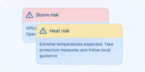
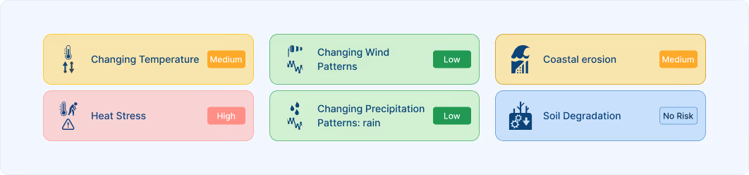
Understand which infrastructure assets are most vulnerable to heatwaves, floods, storms, or freeze-thaw cycles based on localised projections and historical trends.
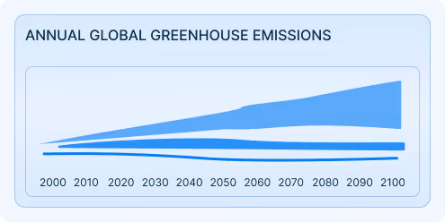
Scenario-Based Planning &Investment Strategy
Use climate data under multiple emissions pathways to assess future environmental stressors and prioritise adaptive investments.
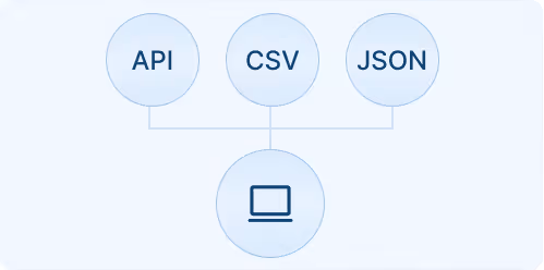
Integration into Engineering & Planning Tools
meteoblue data can be used in GIS, BIM, and asset management systems — supporting cross-team collaboration and data-driven design.
Why Infrastructure Professionals Choose meteoblue
Data made for design and engineering
We offer the parameters and temporal resolution infrastructure professionals need, not just generic climate summaries. Hourly projections up to 2100, all RCP/SSP scenarios, extreme precipitation events, wind stress, and heat exposure with engineering-relevant thresholds and return period analysis.
Aligned with global planning and ESG frameworks
Our indicators support CSRD, EU Taxonomy, TCFD, and other disclosure requirements relevant to infrastructure development and funding. With 800+ reports validated by Big 4 auditing firms, satisfy regulatory requirements while informing long-term resilience planning. Transparent documentation proves due diligence for investors and regulators.
Seamless integration with infrastructure tools
API-ready datasets, maps, and reports fit directly into your digital workflows, whether for feasibility studies or risk modeling.
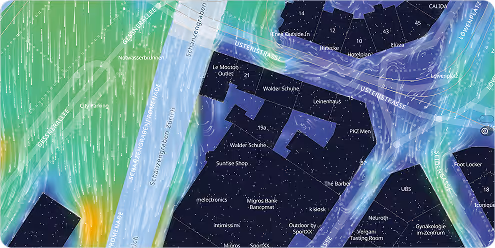
Hyperlocal insights for site-specific planning
With 90m spatial resolution in urban areas and building-level downscaling for critical variables, our data supports design decisions for roads, bridges, tunnels, and utilities.
Download a Climate Risk Report for the location of Basel
A sample report for Basel is available for download - consistent climate data can be generated for any location globally, providing the essential comparability.
Success Stories

meteoblue and KPMG Norway Partner to Deliver Climate Risk Assessments
meteoblue and KPMG Norway have formed a strategic partnership to deliver site-specific climate hazard, exposure and vulnerability data for Norwegian companies.
The climate risk analysis of meteoblue serves the geo-physical dimensions of the EU taxonomy in a scientifically sound, spatially high-resolution and detailed way for the climate-relevant variables. Major auditing firms have meanwhile audited and certified meteoblue climate risk analysis procedure.

Explore our Weather APIs
Premium Weather API
High-resolution forecasts, historical weather data, and interactive meteograms for any location worldwide.
Weather Maps API
80+ Dynamic weather map layers and tiles with global coverage.
Dataset API
Bulk weather data transformations in NetCDF, CSV, and JSON formats for large-scale analysis and modeling.
Weather Warnings API
Real-time severe weather alerts with customisable thresholds and geographic targeting for operational safety.
Climate Data API
Historical climate data and validated projections for risk assessment and ESG reporting.
Measurements API
Real-time and historical observations from weather stations around the globe for monitoring and validation.
Personalisierte Lösungen
Transform your operations with cutting-edge weather insights.
