Urban Maps
meteoblue Urban Maps visualise critical urban weather patterns such as temperature and thermal stress distributions, wind fields and pluvial flood at high spatial resolution.

Precision Tools for Long-Term Urban Climate Resilience
100+
Cities worldwide rely on meteoblue for continuous urban climate monitoring.
150+
Weather stations power our largest high-density city measurement network.
6+
Years of uninterrupted operation in our longest-running urban climate monitoring system.
A New Level of Urban Climate Intelligence
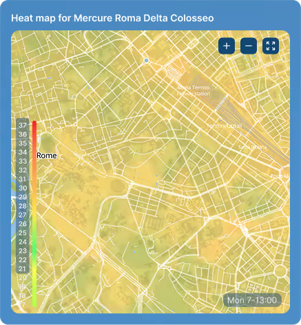
Street-Level Resolution
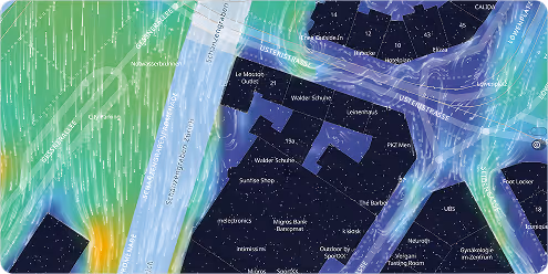
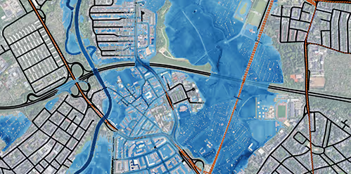
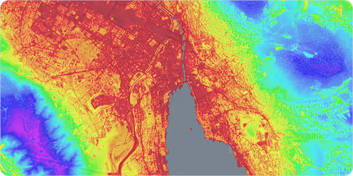
Our urban maps deliver detailed, street-level visualisations based on advanced climate modelling, covering not only temperature but also variables air temperature, physiological equivalent temperature (PET) (or simple heat stress), wind speed & direction, pluvial flood. With resolutions down to 1 metre, planners can identify critical weather-related risks across specific neighbourhoods and infrastructure zones.
Real-time climate monitoring
A dynamic, real-time approach to urban climate monitoring that captures the variability of every hour and delivers up-to-the-minute insights and reliable forecasts up to 7 days ahead for more informed, precise decision-making.
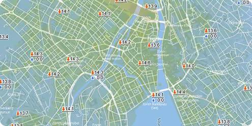
Improving Accuracy with an IoT Sensor Network
By integrating our urban climate models with a local weather station network, cities can validate and refine forecasts using real-world measurements. This enhanced setup not only increases data accuracy but also enables long-term monitoring of climate adaption efforts and supports evidence-based decision-making.
Data-Driven Urban Planning & Design
Identify critical microclimate conditions such as heat hotspots, or wind exposure to guide green infrastructure investments, assess climate risks for new developments, and design buildings and public spaces that improve comfort, energy efficiency, and long-term resilience.
meteoblue offers us flexible solutions and has worked with us to establish a long-term measurement network that provides accurate measurements and quality-assured real-time data. This data gives us important insights into temperature trends in the city. This enables us to take targeted measures to promote the well-being and quality of life of our population.

Sectors we work with
Energy
Optimize renewable generation and protect critical infrastructure with precise forecasts that prevent equipment failures and maximize output across all your energy assets.
Agriculture
Make smarter farming decisions with weather intelligence that protects crops, optimizes field operations, and maximizes yields while reducing resource waste.
Transport & Logistics
Keep fleets moving safely and efficiently by predicting road conditions, optimizing routes around weather risks, and reducing delays from unexpected weather events.
Urban Resilience
Build cities prepared for tomorrow's climate by designing infrastructure that withstands future conditions and protecting critical systems from extreme weather.
Leisure
Deliver exceptional visitor experiences by planning events with confidence, ensuring guest safety, and optimizing operations based on accurate weather forecasts.
Sustainability
Meet climate reporting requirements with regulatory-compliant data that demonstrates environmental progress and aligns business strategy with science-based targets.
Personalised solutions
Transform your city planning with cutting-edge weather insights.
