Premium Weather API
Access our entire suite of weather data with a single API key. Get global forecasts, 80+ years of historical data, and stunning visual assets to power your most demanding applications.


The All-in-One Weather Solution
Build Powerful Weather-Driven Applications
Give your team the competitive edge with full-spectrum weather data: historical insights, real-time conditions, and accurate forecasts.
- One API suite for all your weather needs
- Enable your team to build any weather feature imaginable
From Historical Analysis to Future Prediction
Combine 80+ years of historical weather data with live forecasts to optimise operations and validate system performance.
- Tailored to sector-specific use cases in agriculture, renewable energy, aviation and other fields
- Gain a data-driven understanding of how weather influences your business
Publication-Ready Visuals
The Image API instantly delivers ready-to-use charts and meteograms based on our weather data.
- Visualise complex data with a simple API call
- Enhance your application with professional weather graphics
Forecast Variables for All Use-Cases Imaginable
General Data Packages
Most common weather variables for general purposes and current weather information, including observations and measurements.
Agronomical Packages
The Agro data package serves agricultural purposes and contains soil and vegetation related weather variables.
Renewable Energy Packages
The Solar data package contains specific solar radiation variables for the solar energy sector.
Advanced Packages
The Advanced Packages provide specialised forecast data that extends beyond general weather conditions to include additional atmospheric and environmental variables.
MultiModel Packages
The MultiModel data package contains raw model output for all models available for the selected location, without any post-processing, down-scaling or corrections.
Long Term Forecast Packages
Calibrated probabilistic long-range forecasts for key weather and climate variables.
30+
Weather models provide a unique range of data
3,000+
Business customers from more than 100 countries around the globe
250,000+
Weather stations enable world’s highest precision
Delivering Precision at Scale

Access to 100+ Variables
Including both general and sector-specific variables such as temperature, wind, and solar radiation reaching 5min resolution.

Ready-to-Use Data for Analysis & Modelling
Instantly integrate clean, gap-free data for applications such as risk assessment, trend analysis, supporting sector-specific operations, or machine learning model training.
Flexible and Fast Integration
Easy-to-use RESTful API with clear documentation and fast response times. Additional transmission options include FTP, E-Mail and customisable data formats.
Scalable, Customisable & Always Available
Whether you're working with one location or thousands, the API scales with your needs. Combine forecast and historical data for advanced analytics and decision-making.

Utilise 80+ Years of Consistent Historical Data
Access long-term weather records to analyse trends, benchmark performance, and support reliable modelling and risk assessment.

Powered by meteoblue Learning MultiModel (mLM)
The meteoblue Learning MultiModel (mLM) optimises forecasts for your weather stations by training on historical measurements, selecting a customised model combination, and integrating real-time observations for improved local nowcasting.
meteoblue? One of the unique selling points is definitely the quality of the forecast. The accuracy. Other than that, it is the fact that they operate globally. For us, these are the fundamental factors.

Choose from a Wide Range of Meteograms
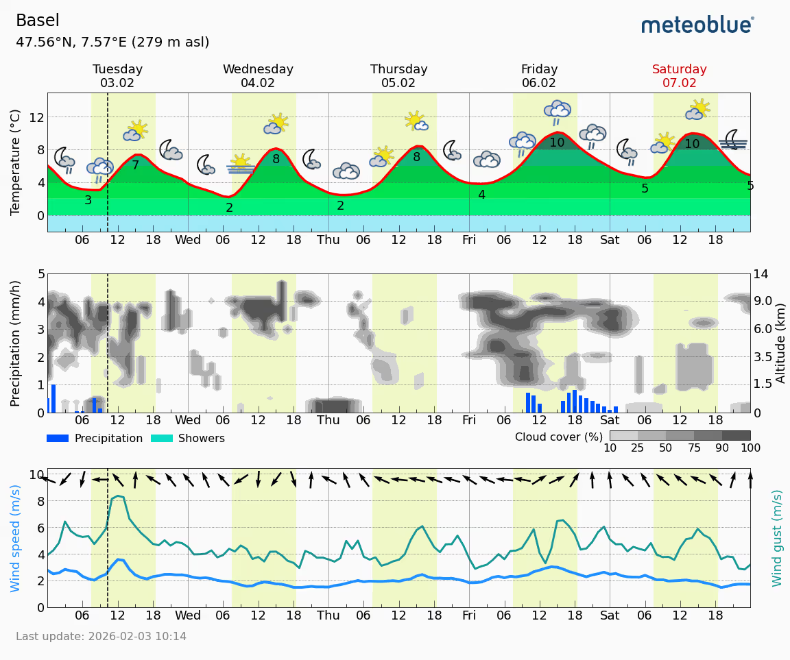
Meteogram 5-Day
Provides a 5-day forecast of weather conditions, including temperature, precipitation, and wind.
.avif)
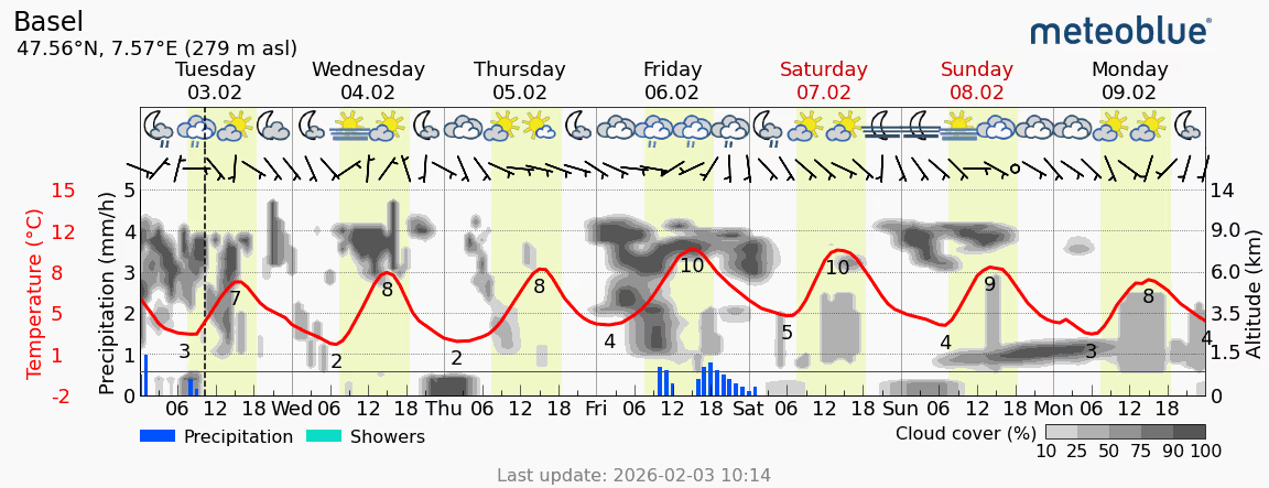
Meteogram 7-Day
Provides a seven-day forecast of weather conditions, offering a broader view compared to the 5-day version.
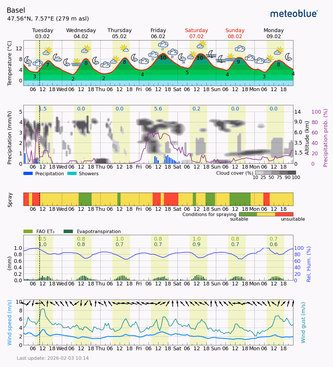
Meteogram All-in-One
Combines various weather elements like temperature, precipitation, wind, and cloud cover into a single, comprehensive forecast.
.avif)
Meteogram Snow
Focuses specifically on snow-related weather information like snowfall amounts, snow depth, and freezing levels.
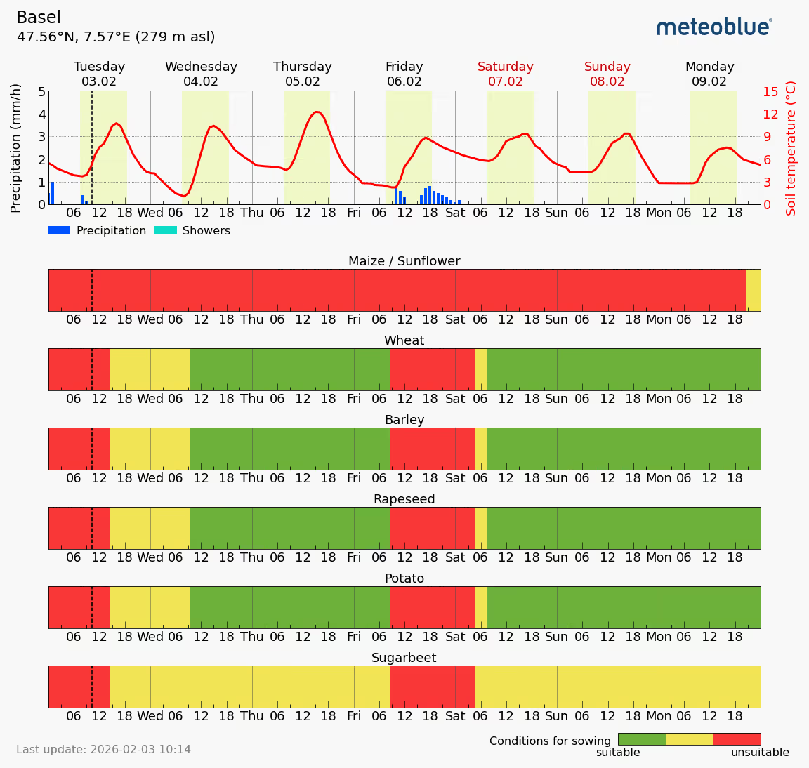
Meteogram Agro
General Meteogram for agricultural weather forecasts, including various options like spraying, temperature, precipitation or wind.
Meteogram Sowing Windows
Provides weather information crucial for optimal planting times and germination conditions.
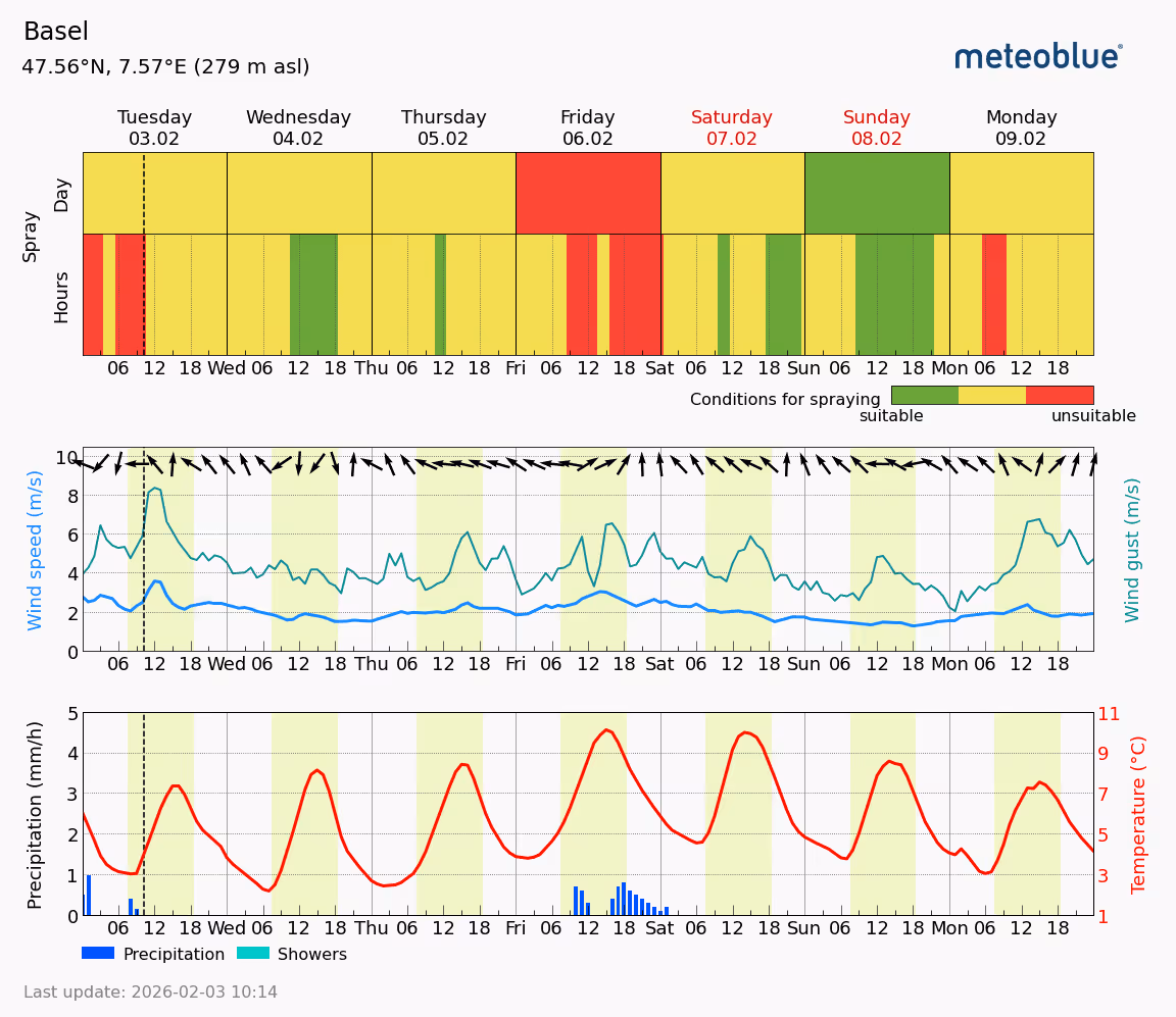
Meteogram Spraying Window
Focuses on weather conditions impacting the effectiveness and safety of applying pesticides and fertilizers.
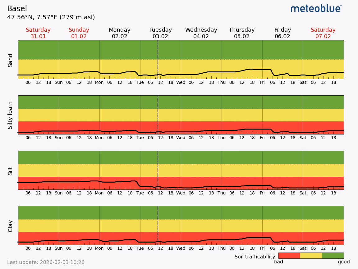
Meteogram Soil Trafficability
Assesses the ground's suitability for machinery movement based on weather conditions and water content in the top soil (0 - 10cm).
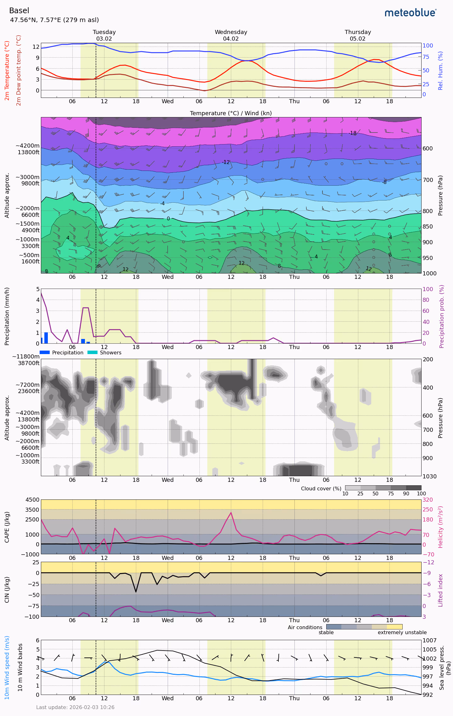
Meteogram Air
General Meteogram for aviation-specific weather forecasts, including CAPE, CIN, Altitude approx. and more.
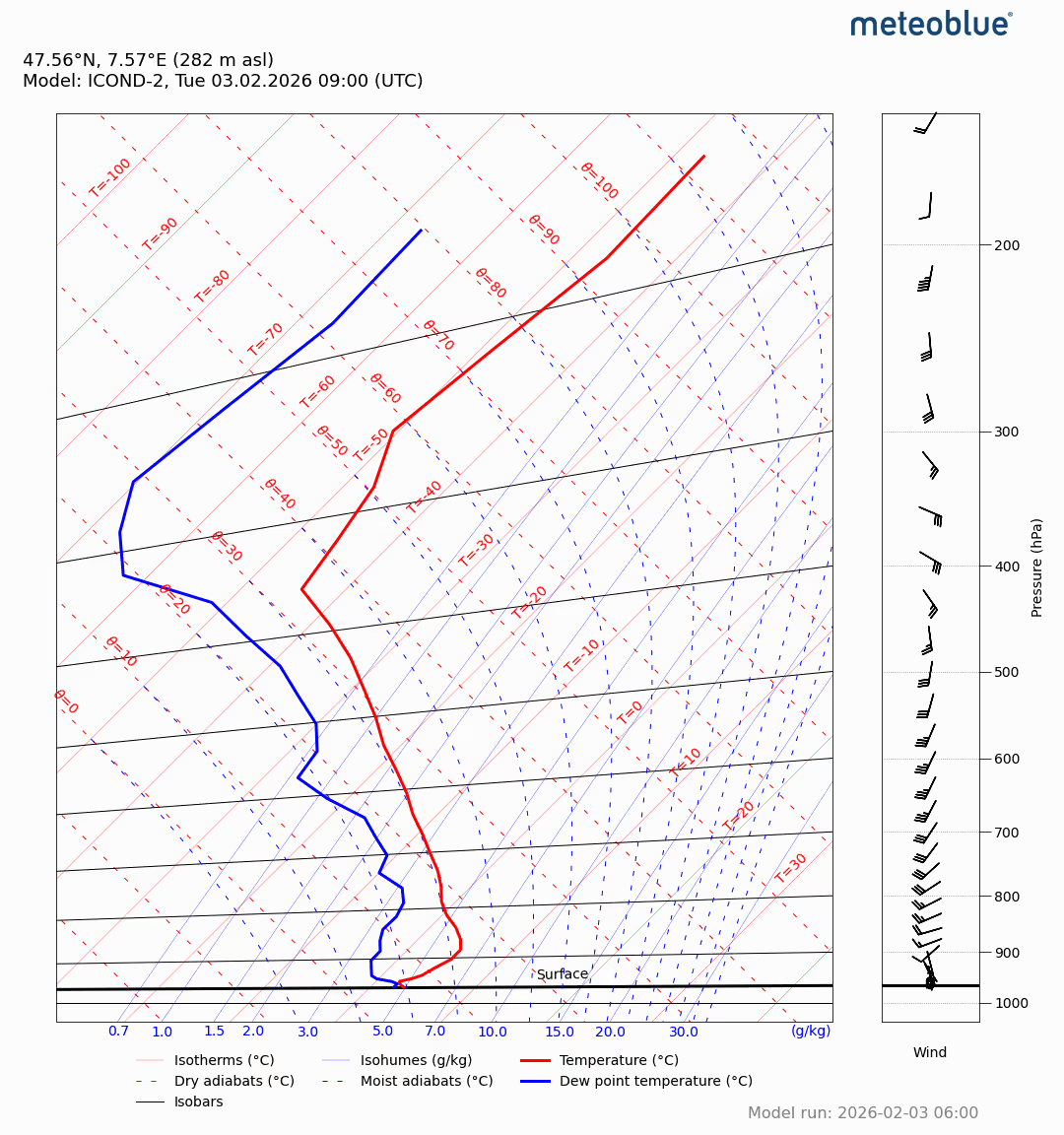
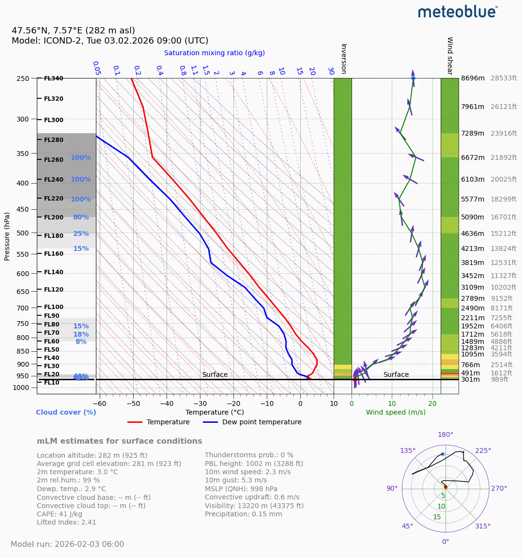
Sounding - Diagram
Provides vertical profiles of atmospheric variables like temperature and dew point temperature for flight planning and safety.
Stueve - Diagram
Offers upper-air forecasts for wind speed, direction, and temperature, often used in aviation weather analysis.
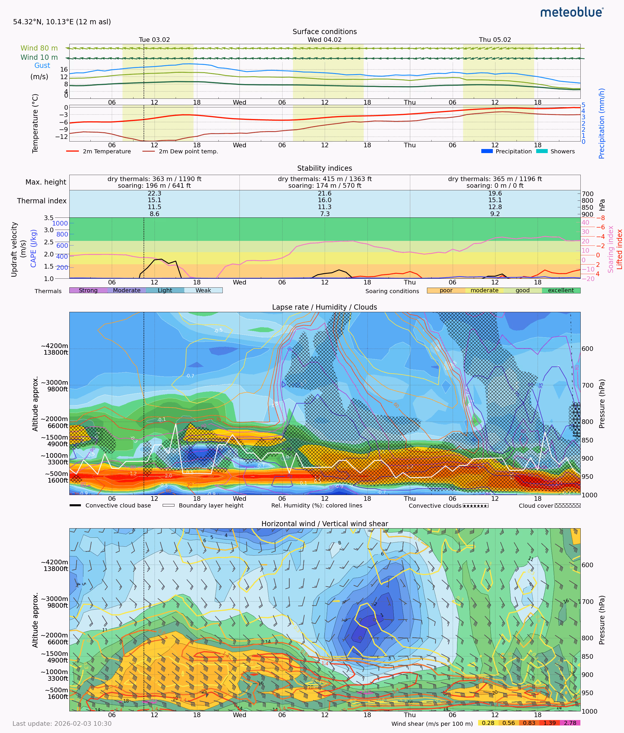
Meteogram Thermal Forecast
Analyses air temperature changes at different altitudes, impacting aircraft performance and flight planning.
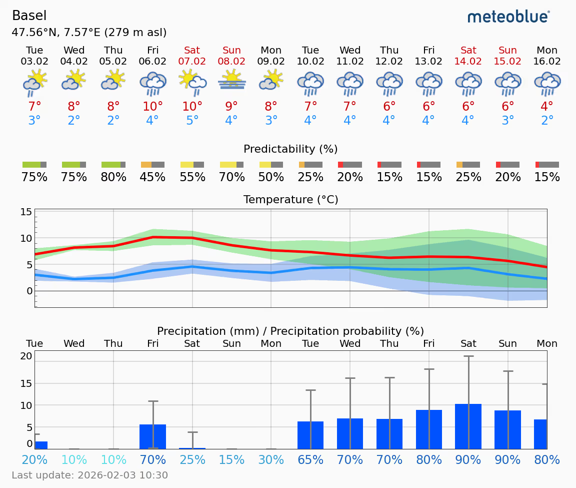
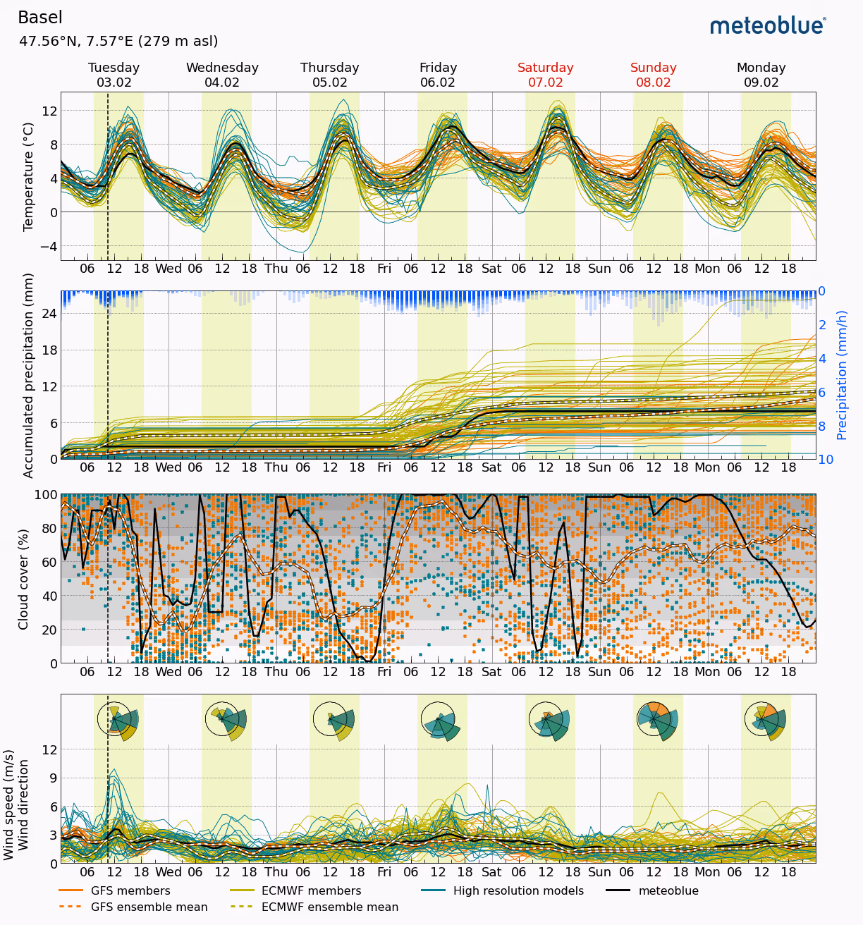
Meteogram 14-Day
Extends the forecast view beyond the usual 7-day range, offering a longer-term perspective.
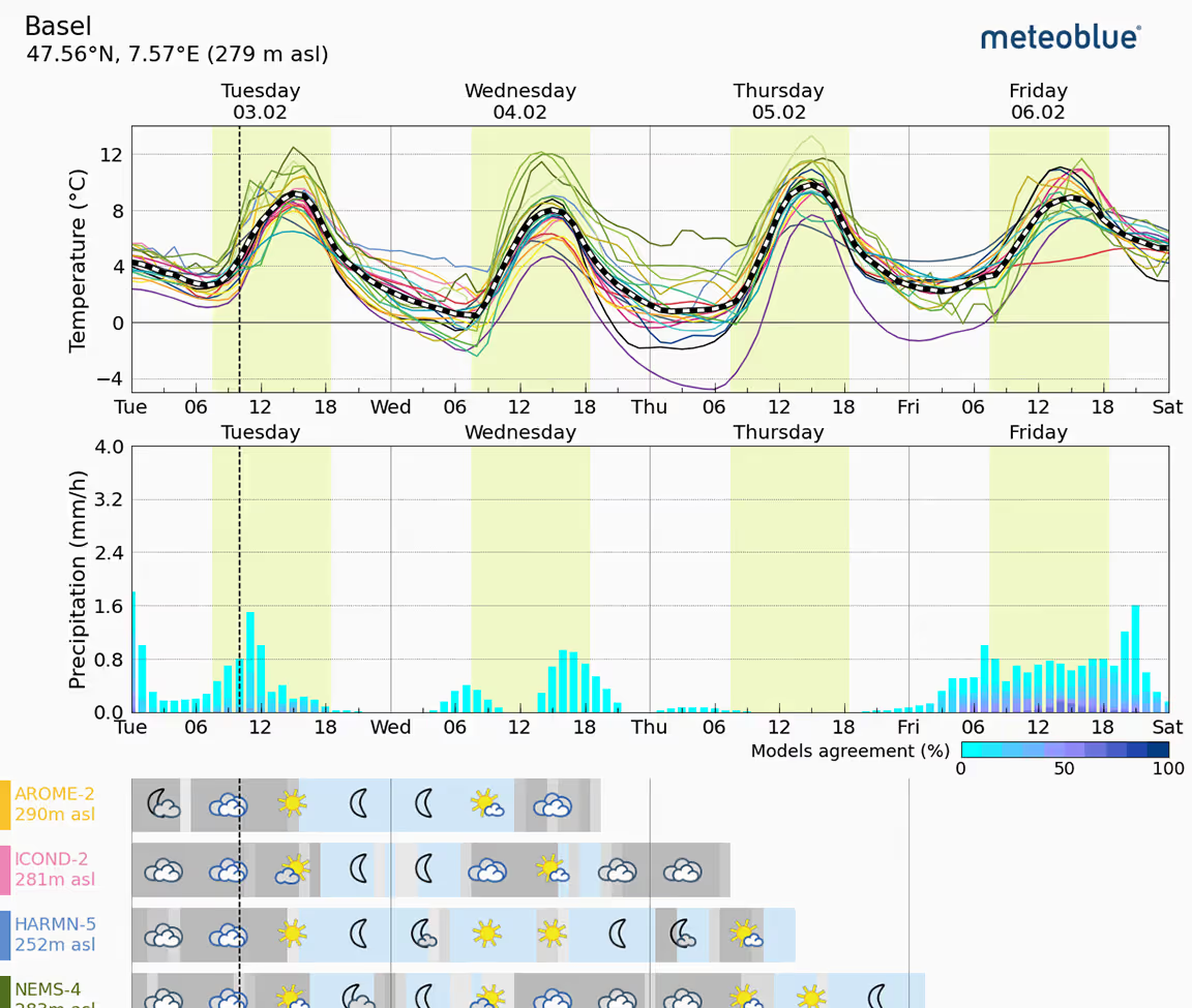
Meteogram MultiModel
Presents forecasts from multiple weather models for comparison, allowing users to analyse potential forecast variations.
Meteogram MultiModel Ensemble
Combines forecasts from multiple models to create a single, statistically representative forecast.
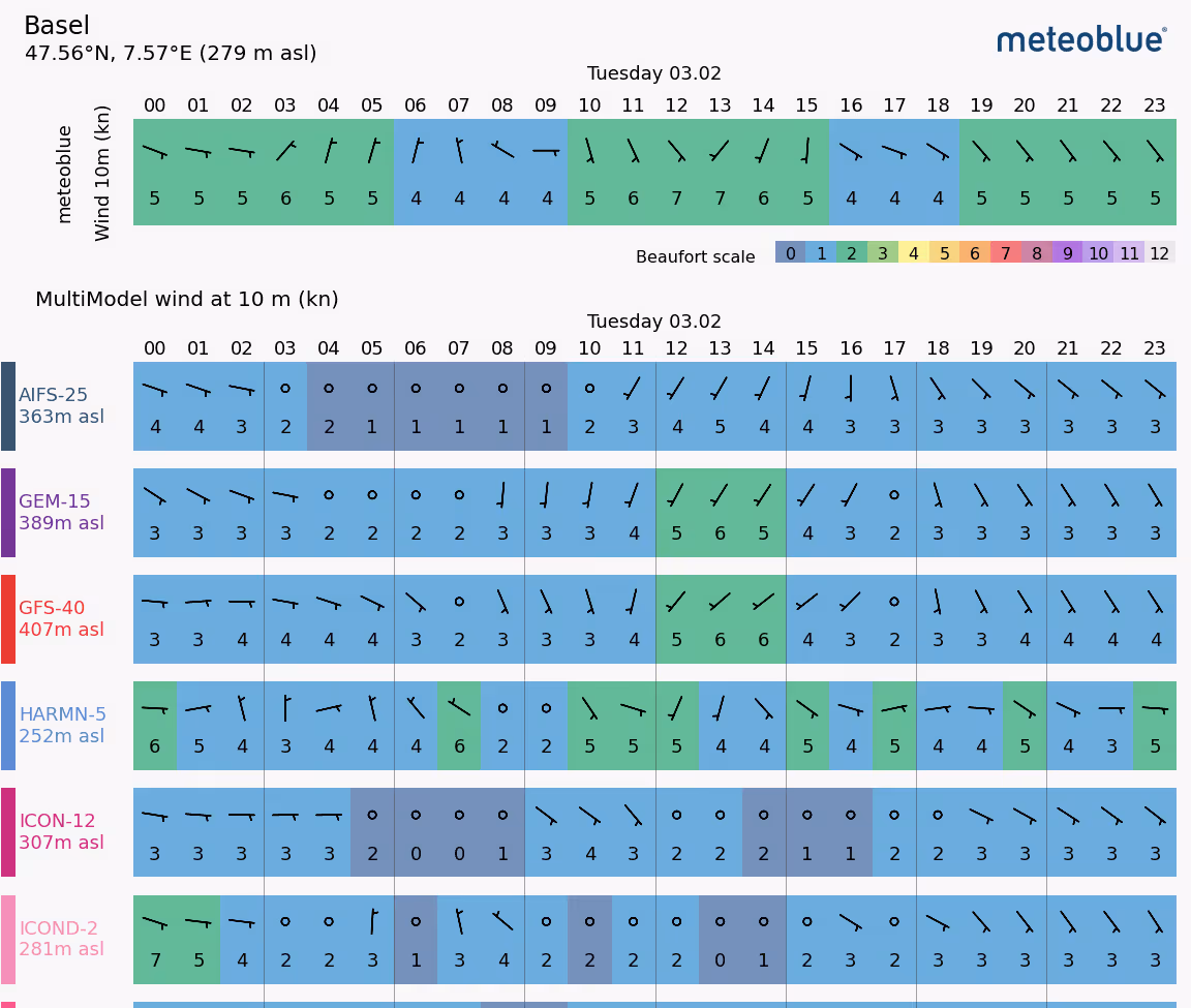
Meteogram MultiModel Wind
Specifically focuses on wind speed and direction predictions from multiple models for a more comprehensive view.
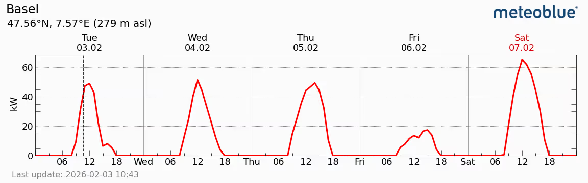
Meteogram Solar Forecast
Predicts PV (photovoltaic) power, crucial for solar energy applications and planning.
.avif)
Meteogram Sea
Provides forecasts of marine weather conditions like wind, waves, and precipitation relevant to maritime activities.
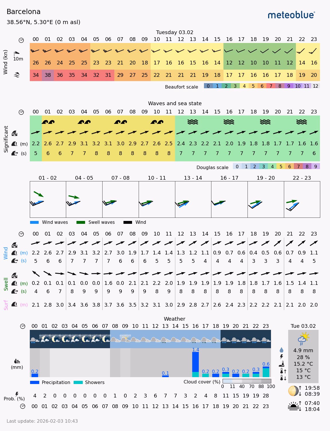
Meteogram Surf
A specialised meteogram showing detailed wind, wave, swell, and weather conditions to support surf planning and coastal activity decisions.
.avif)
Seasonal Forecast Meteogram
The Seasonal Forecast - Diagram displays monthly seasonal forecast anomalies from different models as well as a super-ensemble (ENSEMBLE) created by meteoblue.
Success Stories
Syngenta Crop Protection
Syngenta is a leading science-based agtech company, helping millions of farmers around the world to grow safe and nutritious food, while taking care of the planet.
VitiMeteo - Prognostic system for crop protection in viticulture.
An overview of meteorology and its importance in weather forecasting.

WaterApp - When water becomes scarce
A comprehensive overview of the techniques used in weather forecasting.
How to build a network of weather stations in Africa - TAHMO
A detailed analysis of how climate change is altering weather patterns.
Sectors we work with
Energy
Optimise renewable generation and protect critical infrastructure with precise forecasts that prevent equipment failures and maximise output across all your energy assets.
Agriculture
Make smarter farming decisions with weather intelligence that protects crops, optimises field operations, and maximises yields while reducing resource waste.
Transport & Logistics
Keep fleets moving safely and efficiently by predicting road conditions, optimising routes around weather risks, and reducing delays from unexpected weather events.
Urban Resilience
Build cities prepared for tomorrow's climate by designing infrastructure that withstands future conditions and protecting critical systems from extreme weather.
Leisure
Deliver exceptional visitor experiences by planning events with confidence, ensuring guest safety, and optimising operations based on accurate weather forecasts.
Sustainability
Meet climate reporting requirements with regulatory-compliant data that demonstrates environmental progress and aligns business strategy with science-based targets.
Explore our Pricing Options
Flexible pricing plans designed for organizations from startups to enterprises. Explore the solution that fits your needs.
