Warnings API
Access location-based weather warnings for over 100 countries worldwide. Automatically updated, clearly categorised and ready to integrate into your platform.
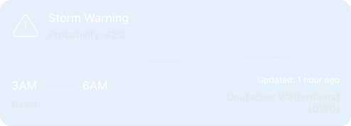



Proactive Risk Awareness with the Warnings API

Official Warnings from 100+ Countries
Access authoritative weather alerts from trusted national and regional providers, aggregated and standardised for global application.

meteoblue Warnings
Use meteoblue-generated risk packages that combine forecast variables into probabilistic indicators for specific weather-related hazards found in the Premium Weather API.
Seamless API Integration
Easily integrate live warning data into your platform, dashboard, app or decision system via a fast and well-documented RESTful API.
Reliable Warnings for Automation
Use warnings to trigger automated responses, inform decision-making, or proactively alert users before risks escalate.
40+
Weather models from meteoblue and national weather services
3,000+
Business customers from more than 100 countries around the globe
250,000+
Weather stations feed into every forecast
I greatly appreciate the competent, creative and trusting cooperation with my colleagues at meteoblue. Time and again we succeed in bringing together the different technical expertise for the benefit of new solutions and designing innovative products for our customers.

Be Prepared for Storms, Earthquakes, Heat Waves and More
Wind
High wind speeds, severe gusts, and storm-force conditions that threaten infrastructure, operations, and safety. Includes tropical storms and damaging wind events.
Thunderstorm
Severe convective activity with lightning, heavy rainfall, strong winds, and potential for multiple simultaneous hazards including tornadoes and downbursts.
Rain
Intense or prolonged precipitation events that may cause flooding, disrupt operations, or compromise infrastructure stability.
Hail
Ice pellet precipitation capable of damaging crops, vehicles, solar installations, and exposed equipment. Critical for agriculture and renewable energy operations.
Snow
Snowfall accumulation and winter storm systems affecting transportation, energy distribution, and operational continuity.
Heat
Extreme high temperatures and heat waves that strain energy grids, threaten worker safety, and impact equipment performance.
Cold
Below-freezing temperatures, frost events, icing conditions on roads and infrastructure, and extreme cold that threatens operations and assets.
Low Visibility
Reduced visibility from fog, dust storms, smoke, or blowing snow that impacts transportation, aviation, and outdoor operations.
Flood
Flash flooding, river overflow, urban flooding, and storm surge that threatens infrastructure, supply chains, and operational facilities.
Coastal
Marine hazards including storm surge, high waves, coastal erosion, and maritime conditions affecting ports, offshore operations, and coastal infrastructure.
Forest Fires
Wildfire risk assessment, active fire detection, and fire weather conditions. Critical for utilities, forestry operations, and communities in fire-prone regions.
Avalanches
Snow avalanche risk zones and warnings for mountain operations, ski resorts, transportation corridors, and alpine infrastructure.
Geological
Ground movement events including landslides, mudslides, subsidence, and slope failures that threaten infrastructure and operations.
Volcanic
Volcanic activity monitoring, eruption warnings, and ash cloud dispersion that impacts aviation, air quality, and regional operations.
Earthquake
Seismic events and ground shaking that threaten structures, utilities, and critical infrastructure. Essential for risk assessment and emergency response.
Air Quality
Atmospheric pollution levels, particulate matter concentrations, and air quality index warnings affecting public health, outdoor operations, and regulatory compliance.
Success Stories

Case Study: High-Resolution Climate Modelling for the Swiss Rail Network
meteoblue provided SBB and Allianz Fahrweg with high-resolution climate data and long-term projections to reassess neutralisation temperature standards across Switzerland's rail network.
meteoblue and KPMG Norway Partner to Deliver Climate Risk Assessments
meteoblue and KPMG Norway have formed a strategic partnership to deliver site-specific climate hazard, exposure and vulnerability data for Norwegian companies.
Syngenta Crop Protection
A leading science-based agtech company using meteoblue forecast and historical weather data across its global crop protection operations.

Our Partnership with Microsoft Flight Simulator
Our Partnership with Microsoft Flight Simulator
Solar-Log and meteoblue: A Partnership Shining Bright for a Sustainable Future

VitiMeteo - Prognostic system for crop protection in viticulture.
A disease forecasting system for winegrowers. meteoblue has supplied the underlying weather forecasts since 2009, including leaf wetness, a variable critical for predicting fungal infection and unavailable from other providers at the time.
Air Navigation Pro and meteoblue: A Soaring Partnership in Aviation
Air Navigation Pro, used by more than 350,000 pilots, integrates meteoblue weather data for wind, clouds, visibility and radar.
Weathering the storm: The partnership between MarineTraffic and meteoblue
How MarineTraffic adds meteoblue weather data to its ship tracking platform to support safety, routing and planning at sea.
WaterApp - When water becomes scarce
A water information service for farmers in peri-urban river deltas in Ghana and Bangladesh. meteoblue supplies location-specific forecasts for Tamale, Ada and Khulna, delivered to farmers through the project app.

How to build a network of weather stations in Africa - TAHMO
A non-profit building a dense hydro-meteorological station network across sub-Saharan Africa. meteoblue has supplied forecasts since 2021, selected for their accuracy in tropical climates.
Sectors we work with

Energy
Optimise renewable generation and protect critical infrastructure with precise forecasts that prevent equipment failures and maximise output across all your energy assets.

Agriculture
Make smarter farming decisions with weather intelligence that protects crops, optimises field operations, and maximises yields while reducing resource waste.

Transport & Logistics
Keep fleets moving safely and efficiently by predicting road conditions, optimising routes around weather risks, and reducing delays from unexpected weather events.

Urban Resilience
Build cities prepared for tomorrow's climate by designing infrastructure that withstands future conditions and protecting critical systems from extreme weather.

Leisure
Deliver exceptional visitor experiences by planning events with confidence, ensuring guest safety, and optimising operations based on accurate weather forecasts.

Explore our Pricing Options
Flexible pricing plans designed for organisations from startups to enterprises. Explore the solution that fits your needs.
