Hyperlocal Forecast and Alerts
Provide high-resolution, street-level predictions powered by advanced weather models and enable threshold-based alerts for critical infrastructure when conditions exceed defined limits.

Urban Weather Requires High-Resolution Forecasting
Empower cities with hyperlocal, real-time weather forecasts and alerts to respond faster, protect communities, and adapt urban operations.
Why meteoblue for Hyperlocal Forecast & Alerting
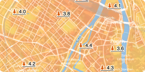
Unmatched resolution for dense urban areas
meteoblue offers 10 m spatial resolution in cities, perfect for street-level and building-level analysis. This granularity ensures compatibility with dense urban sensor networks and enables hyperlocal decision-making.
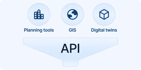
Easy integration into existing systems
Seamlessly connect our APIs to your city dashboards, digital twins, and models to enrich them with real-time and forecast insights. Add measurement data to continuously enhance model accuracy.
Urban-optimised forecast accuracy
We blend global and local forecast models to consistently outperform standard public forecasts, especially in complex urban terrain.
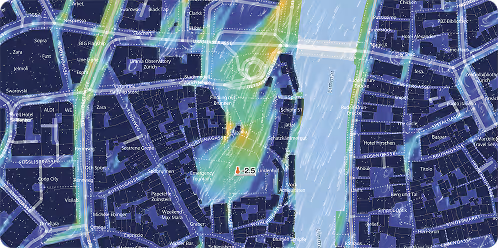
Real-time climate monitoring
A dynamic real-time approach to urban climate monitoring, recognising the variability of each summer day and delivering up-to-the-minute insights for more informed and precise decision-making.
Continuous model refinement
Integrating ongoing real-time data collection to continuously improve and validate the model, ensuring the highest level of precision and effectiveness in climate forecasting.
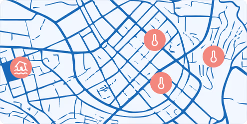
Scientifically-validated LUR
Leveraging a scientifically proven Land Use Regression (LUR) model validated by Burger et al. (2024) to deliver the most accurate and reliable urban climate predictions and insights.
30+
Cities actively using meteoblue sensor-integrated climate systems
10+
Cities with full IoT measurement networks
200+
Urban maps publicly available on meteoblue.com
meteoblue offers us flexible solutions and has worked with us to establish a long-term measurement network that provides accurate measurements and quality-assured real-time data. This data gives us important insights into temperature trends in the city. This enables us to take targeted measures to promote the well-being and quality of life of our population.

We offer custom-made solutions for urban resilience!
For Smart Cities
Integrate meteoblue APIs into IoT dashboards to deliver enriched environmental insights, predictive alerts, and contextual risk overlays.
For Urban Planning
Link sensor measurements with long-term projections to guide adaptive infrastructure planning, policy development, and urban heat mitigation.
For Residence Health
Combine open sensor data with high-resolution weather models for urban health, air quality, or microclimate research and impact studies.
For Infrastructure
Receive hyperlocal forecasts for road conditions, flooding, or heat-related stress to plan maintenance and adjust operations.
Personalised solutions
Transform your smart city with cutting-edge weather insights.
