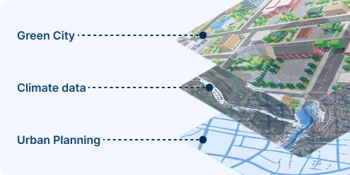
Climate-Ready Planning for Cities of Tomorrow
Neighbourhood-scale climate projections that inform zoning decisions, infrastructure investment, and resilient design. No generic averages – street-level precision validated by 200+ deployed urban maps.


How We Support Urban Planners in Urban Resilience
Heat Risk and Climate-Sensitive Zoning
We provide high-resolution urban temperature maps and thermal comfort projection to support zoning, building regulations, and the development of heat-resilient districts.
Infrastructure Risk and Stormwater Planning
Our precipitation and flood hazard indicators help planners model future runoff, assess flood-prone zones, and design resilient green and grey infrastructure systems.
Climate-Integrated Land Use Strategy
With 10-, 20-, and 30+ year projections of wind, drought, and extreme weather, we support strategic land use decisions that reduce exposure and increase long-term viability of urban projects.
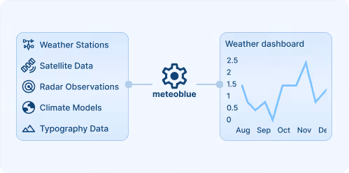
Smart Cities Starts with meteoblue Solutions
From projections to planning decisions
We bridge the gap between climate science and urban planning by delivering data that supports real-world design, policy, and investment strategies.
Neighborhood-scale, planning-relevant insights
Our data goes far beyond national or regional averages, offering precise projections that match how planners actually design and build.
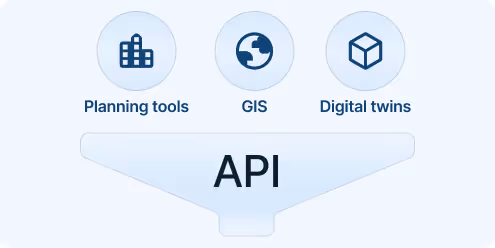
Flexible, digital-ready delivery
Integrate our indicators via API, reports, or the Climate+ platform into GIS tools, digital twins, or urban planning software.
30+
Cities actively using meteoblue urban climate systems
100+
Urban Heat Maps publicly deployed worldwide
10+
Successfully implemented urban planning concepts
We started with a network of measuring stations to monitor the urban climate in Krefeld. Today, we have a comprehensive urban climate analysis from meteoblue and receive temperature forecasts that now also include heat warnings for heat-sensitive population groups.

Explore our Weather APIs
Premium Weather API
High-resolution forecasts, historical weather data, and interactive meteograms for any location worldwide.
Weather Maps API
80+ Dynamic weather map layers and tiles with global coverage.
City Climate API
Urban-scale climate data and indicators for heat, flood risk, and thermal comfort to support resilient city planning and analysis.
Weather Warnings API
Real-time severe weather alerts with customisable thresholds and geographic targeting for operational safety.
Climate Data API
Historical climate data and validated projections for risk assessment and ESG reporting.
Measurements API
Real-time and historical observations from weather stations around the globe for monitoring and validation.
Personalised solutions
Transform your smart city with cutting-edge weather insights.
